|
||||||||||||||

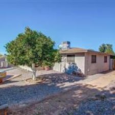
| Features
|
Room Details | Construction & Utilities | Tax & Lease Information |
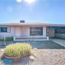
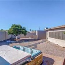
| Approx SqFt Range: 964 Sq. Ft. Features: Fireplace: No Fireplace Garage Spaces: 0 Carport Spaces: 1 Total Covered Spaces: 1 Slab Parking Spaces: 1 Parking Features: none Pool – Private: Pool – Community Spa – Private: Horses: N Property Description: Flat Landscaping: Gravel/Stone Front; Gravel/Stone Back; Exterior Features: 2-Covered Patio(s); Technology: Cable Avail Energy/Green Feature: Ceiling Fan(s) Windows: Dual Pane; Low-E; Wood Frame |
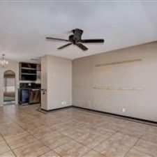
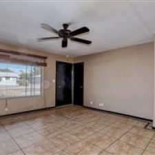
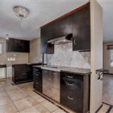
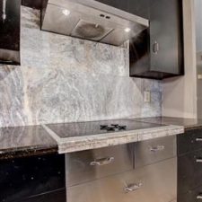
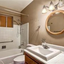
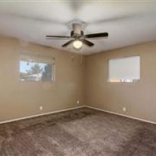
Kitchen Features: Range/Oven Elec; Cook Top ; Disposal; Dishwasher; Built-in Microwave; Refrigerator; Wall Oven(s); Walk-in Pantry; Granite Countertops; Master Bathroom: Shwr & Tub; Double Sinks; Private Toilet Room; Walk-in Shower Master Bedroom: Split Additional Bedroom: Laundry: Washer Included; Dryer Included Dining Area: Formal; Breakfast Bar Basement Y/N:N Sep Den/Office Y/N: N Other Rooms: Family Room; Window Coverings: Drapes; Blinds Flooring: Carpet; Tile; |
Const – Finish: Painted Construction: Frame – Block Roofing: Asphalt Shingle Fencing: Chain Link Cooling: Refrigeration, Ceiling Fans; Roof Vents Heating: Gas Heat Utilities: APS; SW Gas Water: City Water Sewer: Sewer – Public Services: City Services |
County Code: Maricopa AN: 141-47-338 Legal Subdivision: Dreamland Villa 8 Lot Number: 811 Town-Range-Section: 14-1N-6E Census Tract: 040134202.093002 Rent Payable: Owner Possession (Rentals): Immediate Disclosures: Agency Discl Req Forms Required: AAR Lease; Credit Report Other Rent Includes: N/A Lease Information: 12 Month Minimum Pets: Lessor Approval |
Tax and Assessed Values
Aeral Map

Birdseye View

Flood Map
 |
| This property is in Flood Zone: X (shaded) Moderate Risk Moderate risk areas within the 0.2-percent-annual-chance floodplain, areas of 1-percent-annual-chance flooding where average depths are less than 1 foot, areas of 1-percent-annual-chance flooding where the contributing drainage area is less than 1 square mile, and areas protected from the 1-percent-annual-chance flood by a levee. No BFEs or base flood depths are shown within these zones. Zone X (shaded) is used on new and revised maps in place of Zone B. This map layer shows an area’s flood zone designation as determined by the Federal Emergency Management Agency (FEMA). A high-risk area has a 1 percent or greater annual chance of flooding and a 26 percent chance of flooding over the life of a 30-year mortgage. High-risk areas are red or orange. The coast areas, shown in purple, are also considered high risk. Green areas are low to moderate risk. A moderate-risk area is between risk limits of a 100-year and 500-year flood. White areas are undetermined, and all other areas are considered no or low risk. For more details on the categories of flood risk, see http://support.narrpr.com/entries/319901-what-is-the-flood-zone-heat-map. Source(s): FEMA; updated Annually. |
Comps:

Market Trends: